Updated
Why this page exists: it was put together quickly by a local resident to give everyone one place to check what's happening. The works have several phases, the plan has changed more than once, and there has been a lot of concern and confusion. It may contain mistakes, so if this page and the council's differ, go by the council's, and if you spot something wrong, please say so in the community Facebook group.
How it updates: twice a day, at 7am and 3pm, from the council's scheme page and Highways email bulletins. Residents' reports from the Facebook group are added without names or anything that identifies who posted, and are clearly marked.
What the scheme delivers: priority build-outs near St James' Church and The Elms, a 20mph limit through the village, a new footpath to the Mill Lane bus stop, and new street lighting.
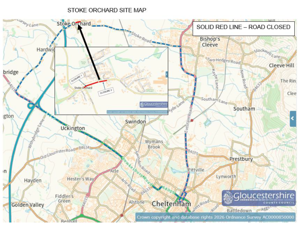
Official plans: Scheme design drawing (PDF): build-outs and 20mph limit · Diversion map
Official sources: GCC Stoke Orchard scheme page · Scheme email updates · Live roadworks map (Stoke Road)
Last checked against the council page:
From residents' posts in the community Facebook group, shared anonymously: no names, car details or anything else that identifies who posted. Not verified by the council.
Against the published plan
Timing, judged only against the council's published dates
Maps are simplified and not to scale. See the council's scheme design drawing for exact positions and the diversion map for routes.
Roles and contact details checked against the county council's councillor directory and the parish council website on 10 Nov 2026.
Dates show when a change was published or first spotted here.